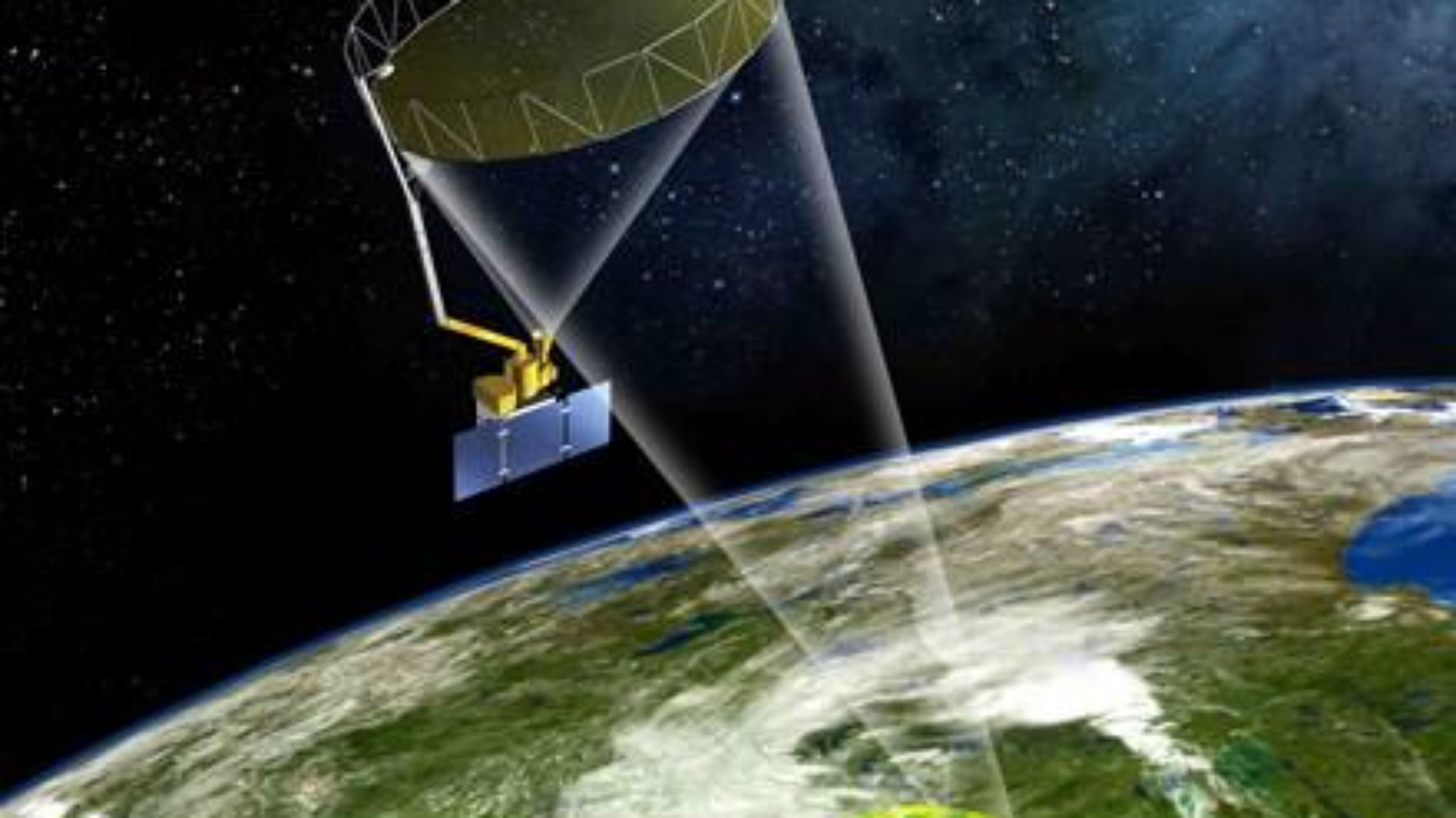


BRENT: A new satellite is about to change the way we look at soil—and provide a much clearer way of predicting droughts and floods.
The National Snow and Ice Data Center in Boulder said that the high resolution satellite will be orbiting high above the Earth by the end of the month.
Amanda Leon of the National Snow and Ice Data Center in Boulder and the data management lead for the SMAP mission said, “It affects so many aspects of our daily life.”
“The floods were a major impact to the area and having one more tool that will help us predict these events and what might happen is going to benefit a lot of people.”
According to the center, SMAP will be able to provide precise and far-reaching views of soil conditions around the world. They also expect the satellite to predict weather events, like floods and droughts.
“It’s unique because for the first time they are combining a radar instrument, which has a really fine resolution and detail in what it sees, and also a radiometer, which can see through clouds and has other benefits,” Leon said.
With the new satellite, measuring soil moisture would not be as time consuming as it used to be. Soil moisture is being measured at the moment by placing probes into the ground. With SMAP, it can be done automatically.
In addition, SMAP is also expected to help in disease control because of its capability to see what soil moisture conditions are like around the world. Researchers and analyst can use these data to predict possible outbreak of illness that might happen such as mosquito-carried illnesses.
Karachi Port sets 138-year cargo handling record
KARACHI: Pakistan's maritime sector has achieved a major milestone as Karachi Port set a new record in its 138-year history...