
NEW YORK: Severe weather in the form of windstorms is not something people expect on Christmas week but a storm system on Dec. 23 brought tornadoes to Mississippi, Georgia and Louisiana. As the storm moved, NASA’s RapidScat captured data on winds while NOAA’s GOES satellite tracked the movement of the system.
RapidScat spotted high winds in the Gulf of Mexico while Mississippi was experiencing tornadoes late on Dec. 23rd. One image RapidScat captured was on Dec. 23 at 1800 UTC (12 p.m. CST) that showed winds as fast as 30 meters per second/67.1 mph/108 kph off the southeastern coast of Texas. As the storm system moved east, on Dec. 24 at 02:00 UTC (Dec. 23 at 8 p.m. CST) RapidScat clocked sustained surface winds of the same strength near south central Louisiana and east of Mobile Bay, Alabama.
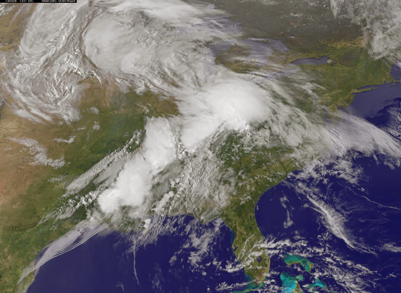
In addition to RapidScat imagery, NASA created an animation of visible and infrared satellite data from NOAA’s GOES-East satellite that showed the development and movement of the weather system that spawned tornadoes affecting the Gulf Coast of the U.S. on Dec. 23 and early Dec. 24.Wide-field animation of NOAA’s GOES-East satellite data from Dec. 21 to 24 shows the movement of storm systems through the U.S., Central and South America. Credit: NASA/NOAA GOES Project
To create the images and the video, NASA/NOAA’s GOES Project takes the cloud data from NOAA’s GOES-East satellite and overlays it on a true-color image of land and ocean created by data from the Moderate Resolution Imaging Spectroradiometer (MODIS) instrument that flies aboard NASA’s Aqua and Terra satellites. Together, those data created the entire picture of the storm systems and show their movement.
Coupled with local weather observations, soundings, and computer models, data from satellites like NOAA’s Geostationary Operational Environmental Satellite or GOES-East (also known as GOES-13) gives forecasters information about developing weather situations. In real-time, the NOAA’s GOES-East satellite data in animated form showed forecasters how the area of severe weather was developing and moving.
According to NOAA’s National Weather Service (NWS), holiday travel on Dec. 24 includes widespread rain for the eastern U.S., snow and wind for the Great Lakes and more snow for the Great Basin and Rocky Mountains.
In the Short Range Public Discussion on Dec. 24, NWS noted: Severe weather will continue to be possible across portions of the Southeast with damaging winds as the primary threat; however tornadoes cannot be ruled out. Strong winds will also be possible from the Tennessee Valley into the Northeast.
NWS forecasts cited “a broad area of steady rain is expected from Florida to New England, with the heaviest rainfall occurring south of the Virginia state line. The southeastern states can expect some strong to severe thunderstorms ahead of the cold front. On the western side of the developing surface low, rain is expected to change to snow from Illinois to northern Michigan, with several inches of snow accumulation a possibility. There will also be a fair amount of wind over this region as the low intensifies. Some higher-elevation snow showers are also possible for parts of the central and northern Appalachians after the cold front moves through.
In the western U.S., a Pacific storm system is expected to bring widespread snow showers from Washington State to the western High Plains on Thursday, Dec. 25 giving many in those areas a white Christmas. The greatest accumulations are expected for the higher mountain ranges of the central and northern Rockies.”

Tesla driverless system to use updated radar technology
WASHINGTON: Electric carmaker Tesla announced Sunday it was upgrading its Autopilot software to use more advanced radar technology. In a...