NEW DELHI: Availability of the river water may fall substantially in North India due to climate change, civil department’s study reveals
Climate change will have a considerable impact on the dynamics of the river Ganga, an IISc study has predicted. This will directly affect a major portion of northern India, which depends on the river for meeting domestic, agricultural, and industrial water needs.
The study carried out by the researchers from the Department of Civil Engineering, Indian Institute of Science, Bengaluru, focused on how the streamflow in the Ganga basin would change under changing land use pattern and climate. Though both the factors affect streamflow, the effect of climate change was much more pronounced than that of land use change. Streamflow is a measure of how much water flows in a river or a stream, and at what rate.
“Looking into the future, with respect to water management efforts, if we conclude that climate change has more implications, then our responses will be much different,” explains Pradeep Mujumdar, the IISc civil engineering professor who led the study.
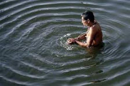
It’s hard to imagine an India without Ganga, its longest river. The 2,500 km river, flowing through the states of Uttar Pradesh, Bihar, and West Bengal, touches 44 per cent of India’s population, before flowing through Bangladesh, and emptying into the Bay of Bengal.
Originating in the mighty Himalaya, the Ganga has a very fertile and large basin that accounts for 30 per cent of India’s cultivable land. In addition to its social and economic relevance, it also has strong cultural presence among Indians. However, there is a dearth of efforts to understand how this massive river is responding to changes along its basin. The researchers studied about one-eighth of the total catchment area, called the Upper Ganga Basin (which is as large as the country of Iceland).
They divided the study region, that also contained the origin of the river, into three different parts depending on the topography, altitude and land use. This region was a natural choice for the study because any changes observed in the streamflow here are likely to be reflected in the entire river.
They studied changes in land use through satellite imagery. Their analysis revealed that, between 1973 and 2011, area under cultivation increased by more than 20 per cent. During the same period, the urban land had also expanded significantly, though it occupied a small area in the entire basin. They also noted an appreciable drop in the area under forest cover. Such changes are not at all surprising because, between 2001 and 2011, the population of the region has skyrocketed by 120 per cent. Their predictions of the future climate indicated changes in rainfall pattern and rise in average minimum and maximum temperatures.