

NEW YORK: This week NASA has launched a new app that allows you to explore the red planet in the style of Google Earth.
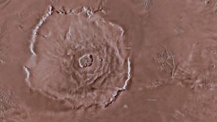
NASA’s Mars Trek is a web app (it should work in most browsers), which allows you to explore Mars through a series of 2D and 3D images that have been collected from a number of NASA missions over the years.
The result is a truly interactive map in the style of Google Earth, which you can pan around and zoom into certain places and features in order to read more about them. There are also links out to even more detailed resources if you come across something that really interests you.
A few other cool features include the ability to add different layers of data over the map, including the paths of past missions and specific landing sites, as well as drawing tools to calculate distances and even a box tool that can generate files so you can 3D print certain features.
If you’re interested in space exploration it’s a really fascinating tool, whether you’re keen to pan around Mars and pretend you’re an astronaut flying over the surface or you want to really get into the nitty-gritty of what’s on Mars’ surface and dive deep into the data and images.

Karachi Port sets 138-year cargo handling record
KARACHI: Pakistan's maritime sector has achieved a major milestone as Karachi Port set a new record in its 138-year history...